Google Maps is an online map that we can access for free from various devices. We can use Maps for directions when we are outside the city, but it is also used to find locations that we have never visited before, or used to see other people’s locations.
There are several types of maps that you can use on Google Maps, namely default, satellite and terrain. With this maps service, we can see the location of our street and house and other locations.
If you want to know the way to a place, whether the location is in the middle of the forest or the city, you can use this feature, because you can see the location directly, although not live.
You can also see the location of your own home on Google maps. Then how do you see your house and street on Google maps? Here’s how to do it.
How To See Houses And Streets On Google Maps
For users who want to try how to see houses and streets on Google maps then you can see the information as follows.
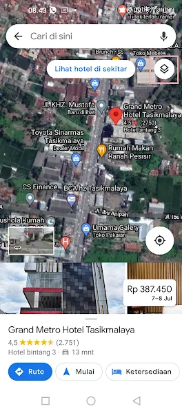
Step 1. Open the Google Maps app on your smartphone then tap on the icon section below.
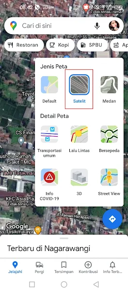
Step 2. Select the type of map satellite.
Step 3. After that tap the location you want to see. Then the name of the location and the path will appear, tap on the box icon as shown below.
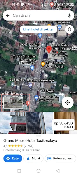
Step 4. Done, so now you can see the location you pointed earlier, you can slide the screen to see the location around there and see the way.

So that’s how to see houses and roads on Google Maps, I hope this tutorial is useful, thank you.
For other interesting information you can also see how to view street cctv with an Android phone without an app which have been discussed in previous tutorials that may be very useful for you. If you found this guide useful, let us know in the comments.